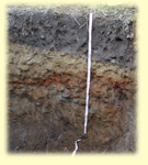
The Soils workshop will be held on Saturday, April 25, 2026 at the UConn Wilfred B. Young Building from 8am-12pm.
One of our most important natural resources is soil. Students will learn the importance of soil in natural resource management and the interrelationships between soil, water, forests, and other resources. Soil is an essential resource for food and biomass production. Soil also provides habitat, ecosystem services like water filtration, and is used as a platform for engineered structures.
The CONNECTICUT ENVIROTHON SOIL MANUAL (linked below) covers a wide variety of soils topics. Students will develop a working knowledge of soil science and soil management, and also an appreciation of the value of our forest resources. Students should focus on the following Learning Objectives.
SOILS STATION LEARNING OBJECTIVES:
Key Point 1: Physical Properties of Soil and Soil Formation
- Describe basic soil properties and soil formation factors
- Understand the landscapes, geologic history, and the origins of the parent materials of Connecticut soils
- Identify soil constituents (e.g. sand, silt and clay, organic matter, pore space)
- Determine basic soil characteristics (texture, structure, etc.) and their relation to soil properties
- Differentiate between soil horizons in a soil profile based upon the physical characteristics (color, texture, structure, redoximorphic features, etc.)
Key Point 2: Soil Ecosystems
- Recognize soil as a vital, living ecosystem that sustains plants, animals, and humans
- Describe the role of soil in the ecosystem, including the hydrologic and carbon cycles
- Understand soil water, its movement, storage, and uptake by plants
Key Point 3: Chemical Properties of Soil and Soil Fertility
- Describe the effect of soil acidity (pH) on nutrient availability
- Understand redoximorphic features and how they are used to interpret seasonal high water table, and how these determine soil drainage class
- Understand the procedure for taking a soil sample and conducting nutrient analysis.
Key Point 4: Soil Conservation and Land Use Management
- Recognize the characteristics of prime farmland and wetland soils
- Differentiate between native forest soils, agricultural soils, wetland soils, and disturbed soils by observing a soil profile
- Identify types of soil erosion and identify methods for reducing erosion
- Understand the effects of various land uses on soils
Key Point 5: Aerial Photography, Topographic Maps, and Soil Surveys
- Be able to use a USGS topographic map
- Identify basic features (roads, woods, fields, buildings, etc.) on an aerial photograph
- Be able to use the USDA NRCS Web Soil Survey
- Utilize soil property and interpretation information from a Soil Survey of the State of Connecticut report
Key Point 1: Physical Properties of Soil and Soil Formation
- Connecticut Envirothon Soil Manual (PDF)
- Basic Soil Properties (PDF; Video) 2020 workshop presentation; USDA-NRCS Connecticut
- Soil Forming Factors and Processes (PDF; Video: Part 1; Part 2)– 2018 workshop presentation, USDA-NRCS Connecticut
- Soil Parent Material (PDF) USDA-NRCS Connecticut
- Soil Texture and Particle Size Analysis by Hydrometer (video) UConn Soil Nutrient Analysis Laboratory
- Texture by Feel demonstration (video) UConn Soil Nutrient Analysis Laboratory
Key Point 2: Soil Ecosystems
- Connecticut Envirothon Soil Manual (PDF)
- Soil Biology Primer
- Soil Health Fact Sheet: Principles for High Functioning Soils (PDF)
- Rainfall Simulator, No-till vs Tilled Soil Properties, and Soil Structure (video) USDA-NRCS Connecticut
- Soil Health Presentation (video) USDA-NRCS Vermont
- Soil Ecosystems, Soil Conservation, and Land Use Management
Key Point 3: Chemical Properties of Soil and Soil Fertility
- Basic Soil Properties (PDF; Video) 2020 workshop presentation, Deb Surabian and Jacob Isleib, USDA-NRCS Soil Scientists
- Sampling Soils for Nutrient Management (PDF) USDA-NRCS
- Soil pH analysis using pH meter (video) USDA-NRCS Connecticut
- Redoximorphic Features (video) USDA-NRCS Connecticut
Key Point 4: Soil Conservation and Land Use Management
- Connecticut Envirothon Soil Manual (PDF)
- Soil Ecosystems, Soil Conservation, and Land Use Management
Key Point 5: Aerial Photography, Topographic Maps, and Soil Surveys
- Connecticut Envirothon Soil Manual (PDF)
- Using Web Soil Survey video series USDA-NRCS National Soil Survey Center
- Envirothon Map Reading Exercise – Exercise – Answer Key
SOILS EXAMS
- Soils Exam 2012 (PDF)
- Soils Exam 2009 (PDF)
- Soils Exam 2007 (PDF)
A few years ago, a soils workshop was held in Old Lyme. The following material was given to students at that workshop. Although this material is not essential study material you may find it very helpful.
The Mock Envirothon test consists of questions from real Envirothon state competitions. The Old Lyme Custom Soil Resource Report is to be used during the mock Envirothon test.
- Mock Soils Exam (PDF)
- Old_Lyme_Soil_Report (PDF)

